SS1
- Stevens Road between Gainsborough Road and Waldgrave Road Nos 1 – 77 and 22 – 130
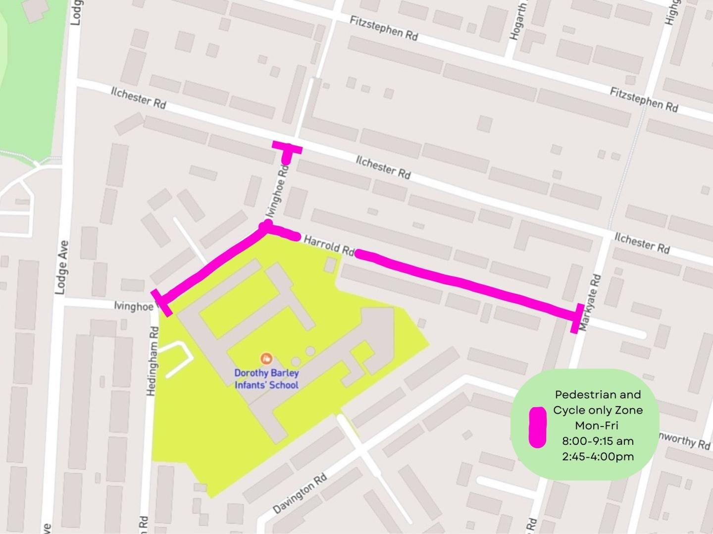
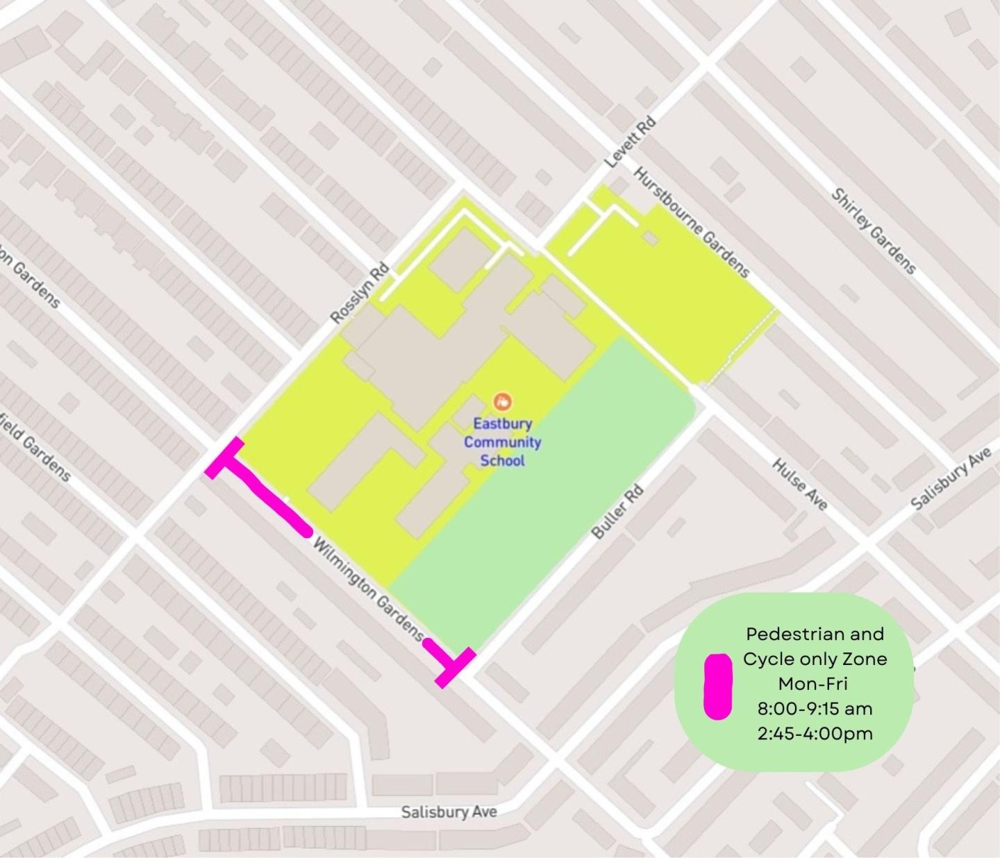
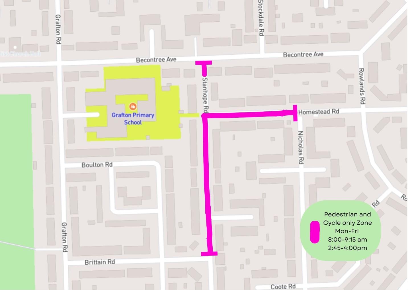
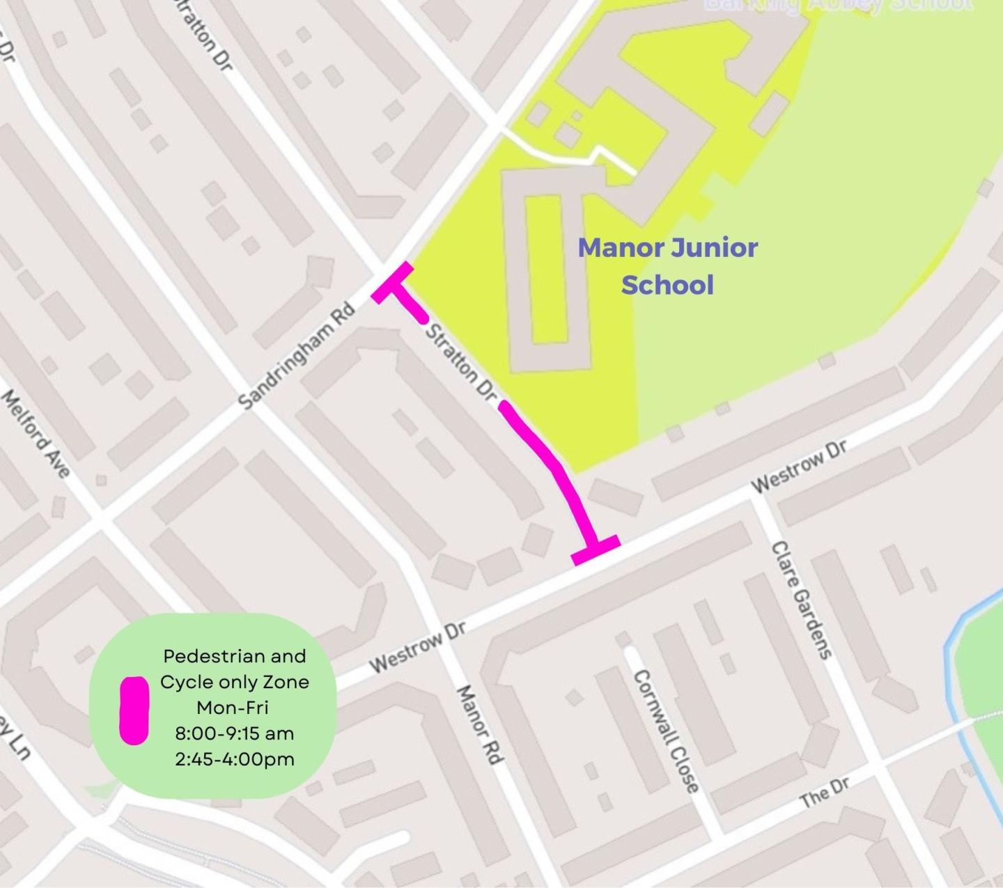
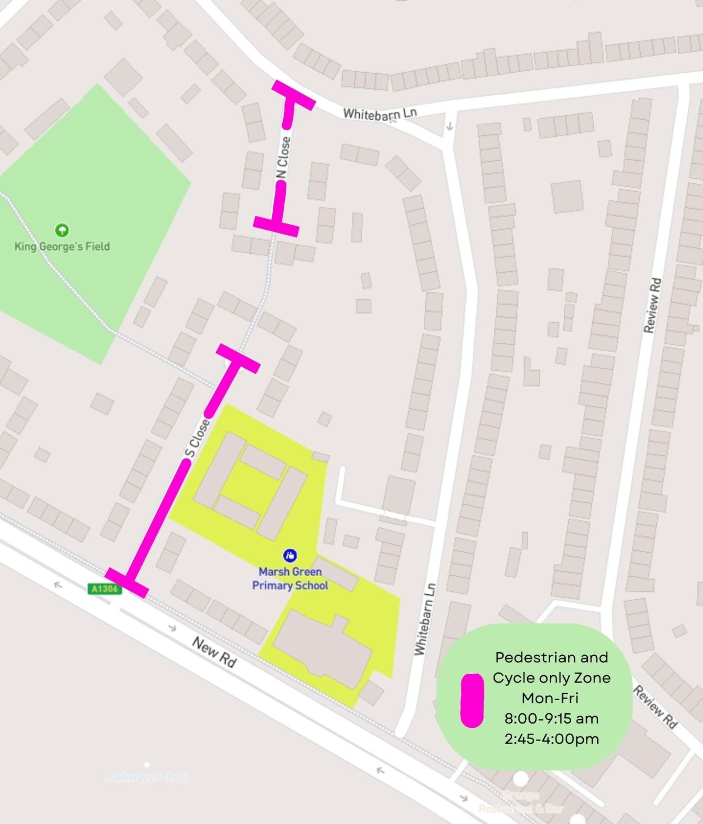
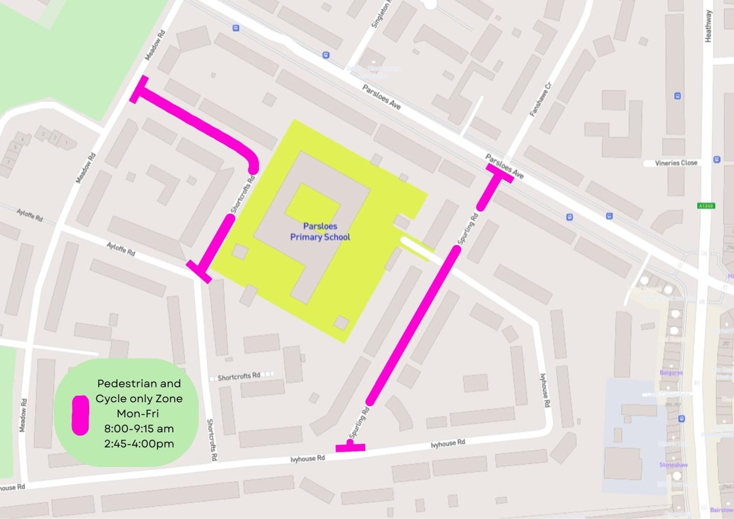
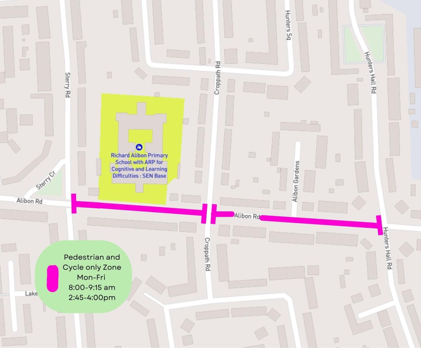
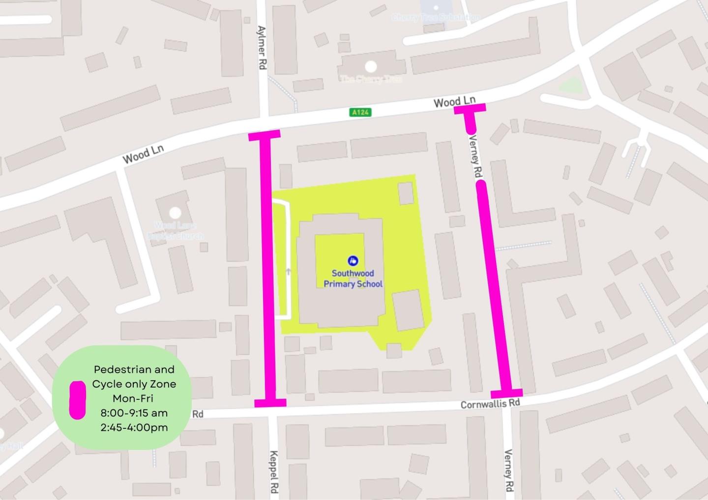
Image
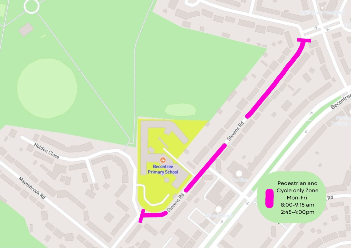
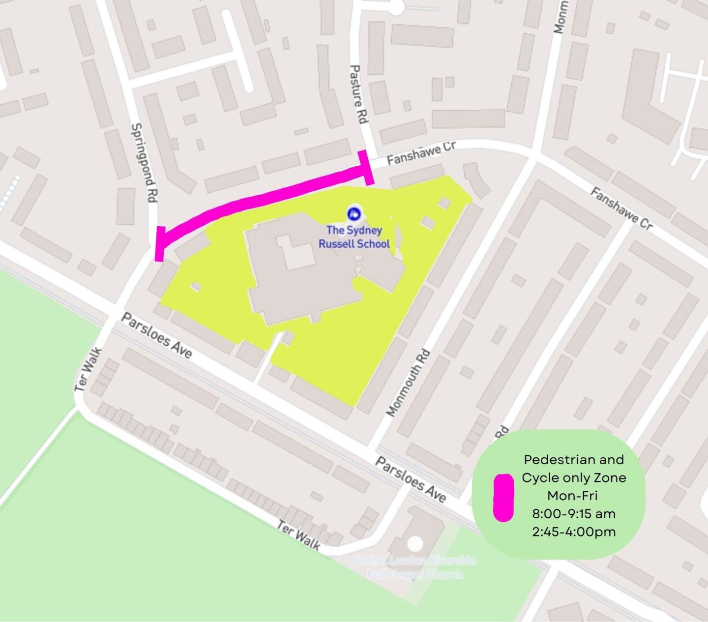
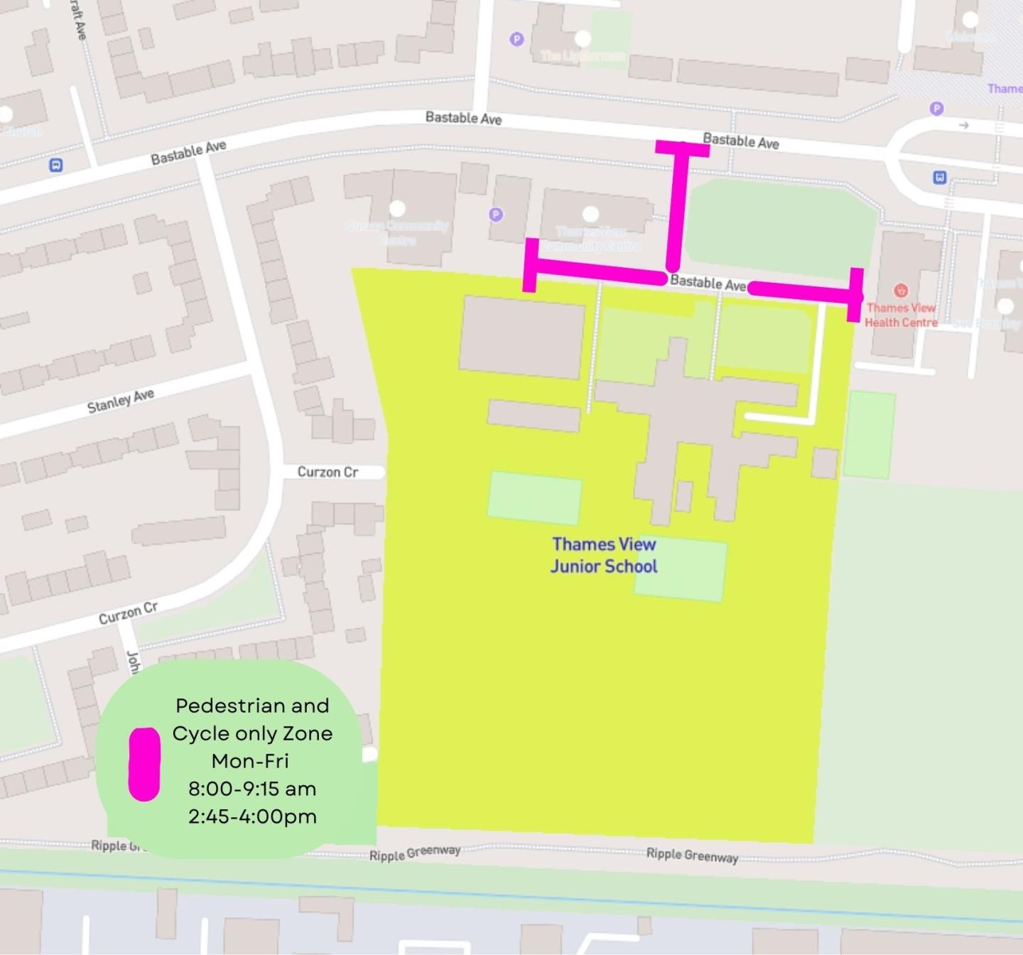
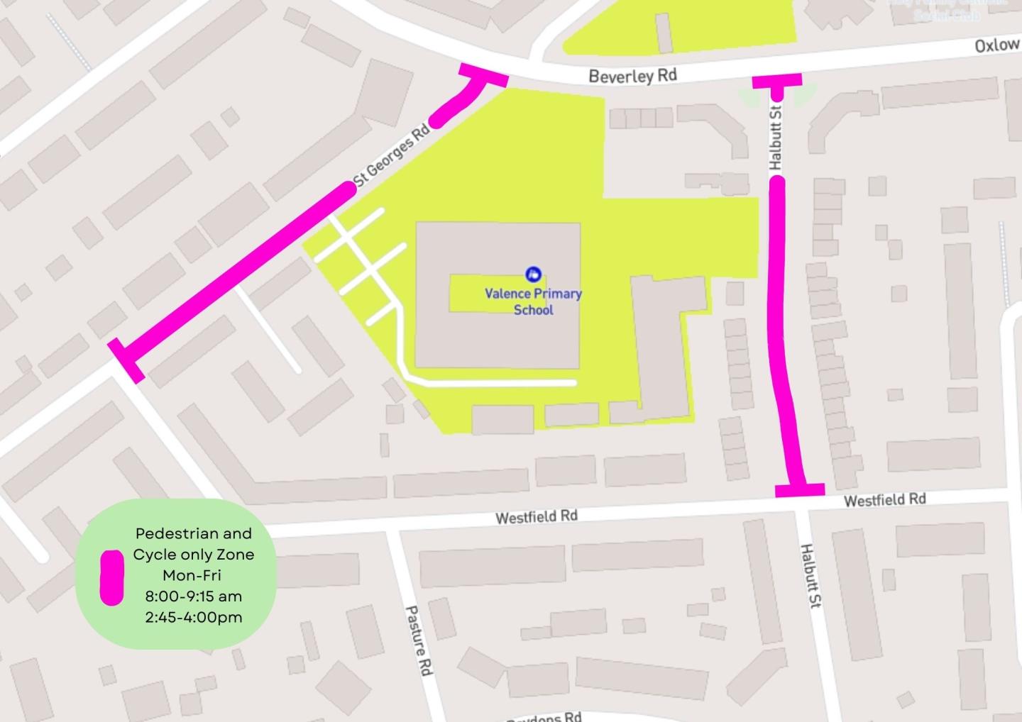
This page provides information on the current School Streets, and also displays a map of each School Street
Please click on the school name to see the location of the School Street for each school.